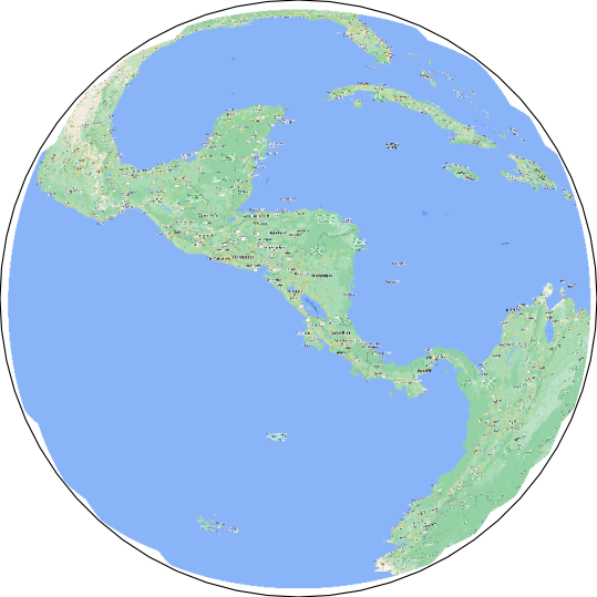
Description
When plotting NearsidePerspective in cartopy using add_image I get many empty areas (as shown on the image) close to the horizon line.
Code to reproduce
Here's the code to reproduce:
import matplotlib.pyplot as plt
import cartopy.crs as ccrs
import cartopy.io.img_tiles as cimgt


plt.figure(figsize=(7, 7), frameon=False)
projection = ccrs.NearsidePerspective(
    central_longitude=-86.055024,
    central_latitude=11.9320027,
    satellite_height=700000,
)
ax = plt.subplot(1, 1, 1, projection=projection)
ax.add_image(cimgt.GoogleTiles(), 7)
ax.set_global()
plt.show()
Full environment definition
Dockerfile where the environment is defined:
FROM jupyter/scipy-notebook:x86_64-python-3.10.9


RUN conda install -c conda-forge cartopy
RUN conda install -c conda-forge gdal

RUN pip3 install countryinfo
RUN pip3 install haversine
RUN pip3 install reverse-geocode
RUN pip3 install pymbtiles

CMD ["start-notebook.sh"]
Description
When plotting
NearsidePerspectiveincartopyusingadd_imageI get many empty areas (as shown on the image) close to the horizon line.Code to reproduce
Here's the code to reproduce:
Full environment definition
Dockerfile where the environment is defined: