
Replies: 4 comments 8 replies

|
Are the existing grids, that were used for the original addressing that David has in drive, going to be utilized somehow? |

|
I suppose we could take a look at those and see if they have value. I would guess since David created them, then they're pretty darn accurate and have been adjusted to reflect what's on the ground. I saw a handful of counties, but not a ton. definitely worth looking at. that's my two cents. curious to hear from others. |
|
I added a link to David's SpillmanBackups folder to the idea resources above, where the grids are scattered about. |

|
Yeah I don't believe David created them as I recall making them originally for the counties I was working on. I think he got them from the original county stewards. I only recall doing the addressing in Kane and Daggett. |
|
Yeah, definitely share any info, back stories, or data that you have on this. It will help shape the discussion and/or next steps. |

|
Status/Progress Update: /remind me on 06/01/2021 |

|
I created an initial python script to build out an address grid, which can be found in my Python-Tools repo at build_address_gridlines.py. Everything is in NAD 1983 UTM 12N (EPSG: 26912), so the units need to be in meters. The script generates an approximate address grid from the following user inputs:
The output looks like a lattice of gridlines, each containing a label with its approximate street name (e.g., 700 E). It does a decent job based on some initial tests in Salt Lake City and Provo (see images below). We knew this would be tricky due to inherent inconsistencies and real-world variations, but when accounting for possible rectangular grids with different x/y block distances, I think this is a good first step. Weaknesses
Salt Lake City
Provo
|
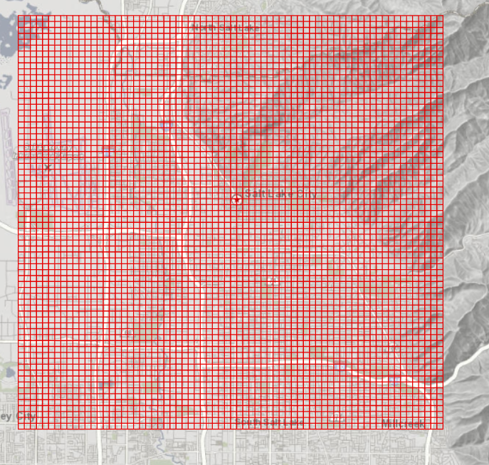
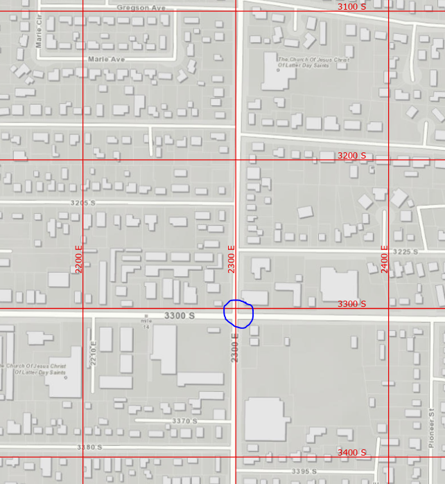
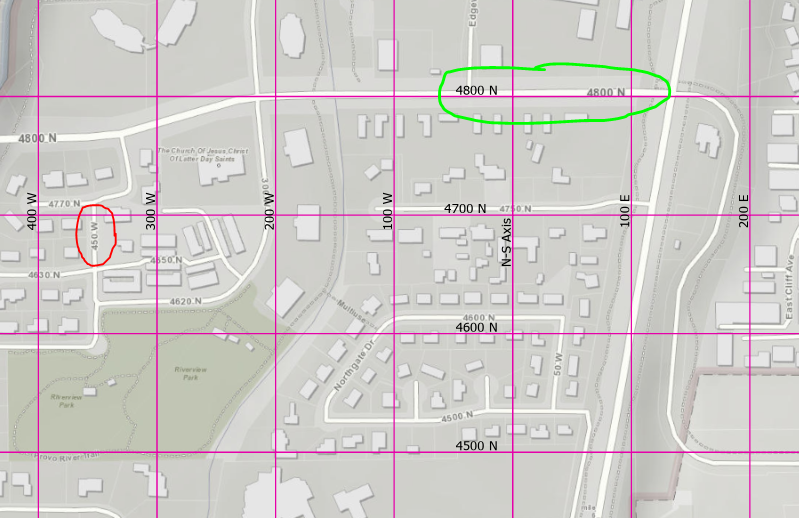

|
You want to share it with Cydne to test or run a test on Elsinore in Sevier Co first? |

|
@mheagin Is Elsinore one of the areas they need? I'll probably share with some folks next week, they'll need to be able to edit and run the script with Python 3 from an ArcGIS Pro install. Otherwise, I could build a grid for someone and send them the final product. Iron county was recently asking about it, so I'll reach out to them. |
|
@eneemann That is the big annexation that is going to go through next week, so she will be bombarded with address requests. Might be best to create a grid and just send it to her, not sure of here coding skills. She trained under Cynthia |
|
Okay, I'll get one going for her. |
|
I've created a google drive folder/directory in the agrc_public_share where we can compile all the known, existing address grids from across the state. I've added Sanpete's grid that I obtained from their GIS dept as well as any other grids I've found in random places in the agrc/ugrc google drive. please add any address grids to this folder that you are aware of. Thanks! |


Uh oh!
There was an error while loading. Please reload this page.
Uh oh!
There was an error while loading. Please reload this page.
What's the idea?
Who would this benefit?
Is funding needed?
Estimated level of work?
What are some of the known steps to make this happen?
Some technical thoughts:
What are some of the known limitations or challenges?
Resources
All reactions