BlenderGIS-IFC is a fork of the original BlenderGIS by domlysz, extended with IFC (Industry Foundation Classes) integration for streamlined GIS-to-BIM workflows.
- Blender minimum version required: v2.83
- Current version: 2.2.14
Note: Since 2022, the OpenTopography web service requires an API key. Please register at opentopography.org and request a key. This service is still free.
Note: A MapTiler API key is required for searching and adding Coordinate Reference Systems (CRS) through the EPSG database. Set it in the add-on preferences.
The biggest addition is seamless IFC integration when importing ESRI Shapefiles. This bridges GIS data directly into BIM workflows using Bonsai (formerly BlenderBIM).
- Assign IFC Class: When importing a shapefile, enable "Assign IFC Class" and specify the IFC class (e.g.,
IfcBuilding,IfcSite,IfcBuildingElementProxy). - Predefined & User-Defined Types: Optionally set IFC predefined types and user-defined types.
- Automatic Property Sets (Psets): When importing with "Separate Objects" enabled, all shapefile attribute fields are automatically mapped to an IFC Property Set called
Pset_GIS_Attributeson each imported object. - Bonsai Integration: Works directly with Bonsai's API to create proper IFC elements, export mesh geometry as IFC tessellation representations, and update the IFC navigation panel.
- Fallback Mode: If Bonsai is not installed, IFC class information is stored as custom object properties.
See IFC_IMPORT_FEATURE.md for detailed usage instructions and workflow examples.
Import multiple shapefiles in one go via Shapefile Batch (.shp) in the GIS menu.
Migrated CRS search from epsg.io to the MapTiler Coordinates API. Requires a free API key configured in preferences.
- Blender 4.x & 5.x compatibility — guards against breaking changes on future major Blender releases.
- macOS Apple Silicon (ARM) support fixes for image I/O.
- Pillow deprecation fixes for recent Python versions.
- pyshp and reprojection engine updates.
Import in Blender most common GIS data formats: Shapefile vector, raster image, GeoTIFF DEM, OpenStreetMap XML, and ESRI ASCII Grid.
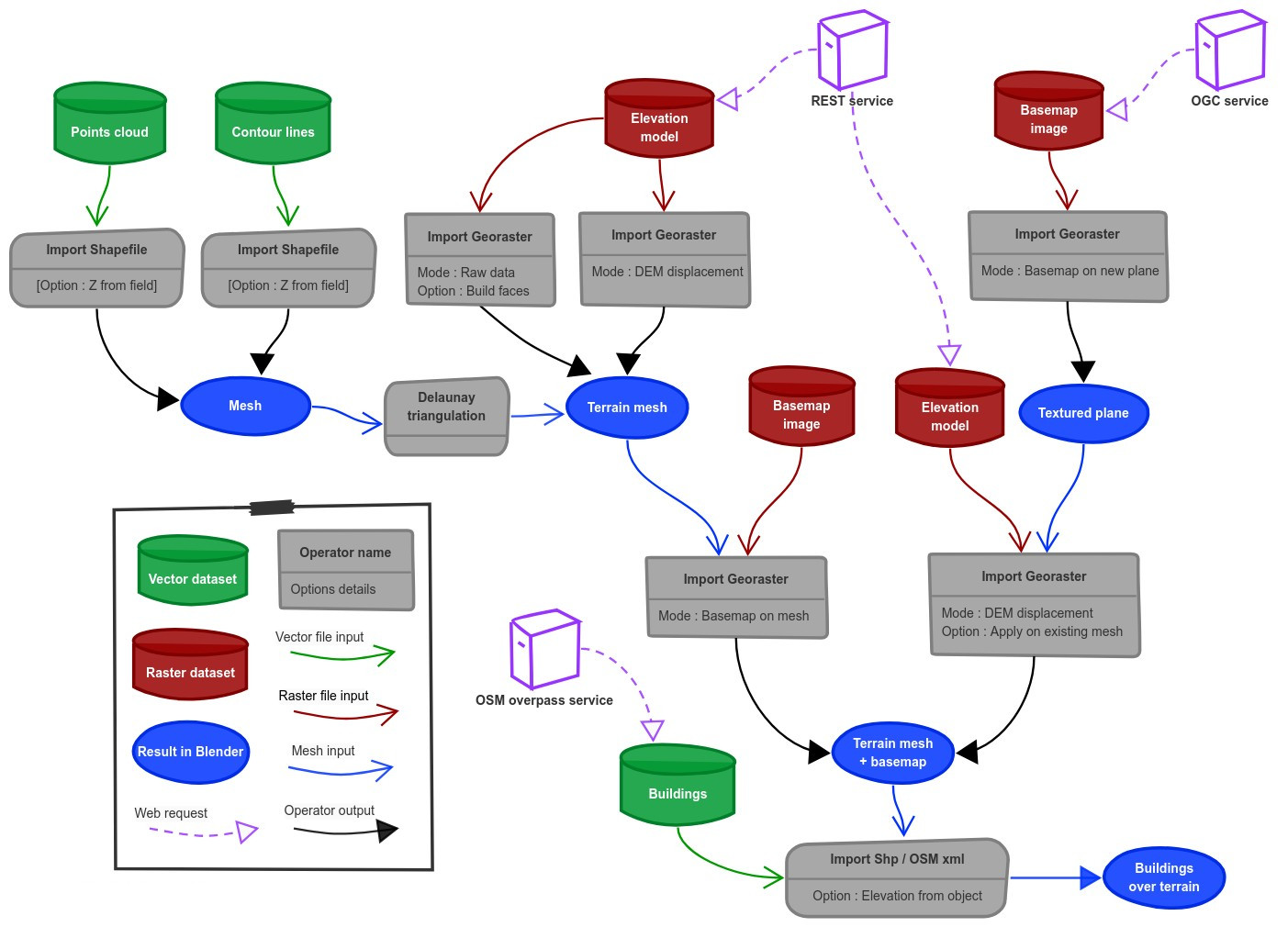
There are a lot of possibilities to create a 3D terrain from geographic data; check the Flowchart for an overview.
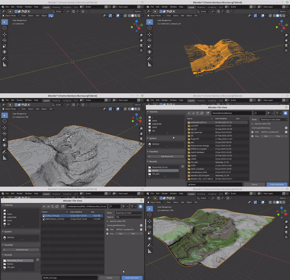
Example: import vector contour lines, create faces by triangulation, and put a topographic raster texture.
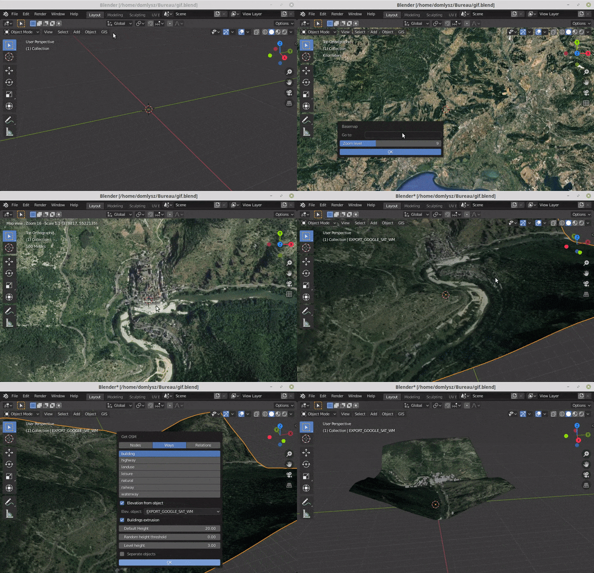
Display dynamic web maps inside Blender's 3D view, request OpenStreetMap data (buildings, roads, etc.), and get true elevation data from the NASA SRTM mission.
- Manage georeferencing information of a scene.
- Compute a terrain mesh by Delaunay triangulation.
- Drop objects on a terrain mesh.
- Make terrain analysis using shader nodes.
- Setup new cameras from geotagged photos.
- Setup a camera to render a new georeferenced raster.
- IFC class assignment and Property Set generation for BIM workflows.
To use the full IFC functionality, install and enable:
- Bonsai (BlenderBIM) — the free and open-source BIM authoring tool for Blender.
- IfcOpenShell — usually bundled with Bonsai; required for Property Set creation.
Both must be active before importing shapefiles with IFC assignment enabled.